
FIELD RESEARCH
Tracing the source of the water.
AquaHemithea’s thermal mineral water was identified through more than ten years of geological, geophysical and hydrochemical investigations in and around Marmaris, carried out jointly by academics from Istanbul University and our company’s specialist engineers.
- Location
- Marmaris, Muğla
- Research area
- Land and marine research
From the project archive
Scenes from the work
24 photos · Select to enlarge
Geology and field observations
Read the field notes
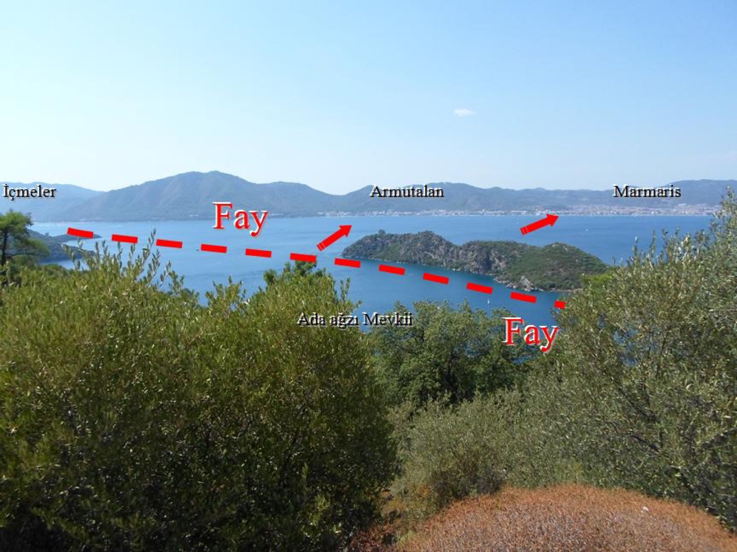
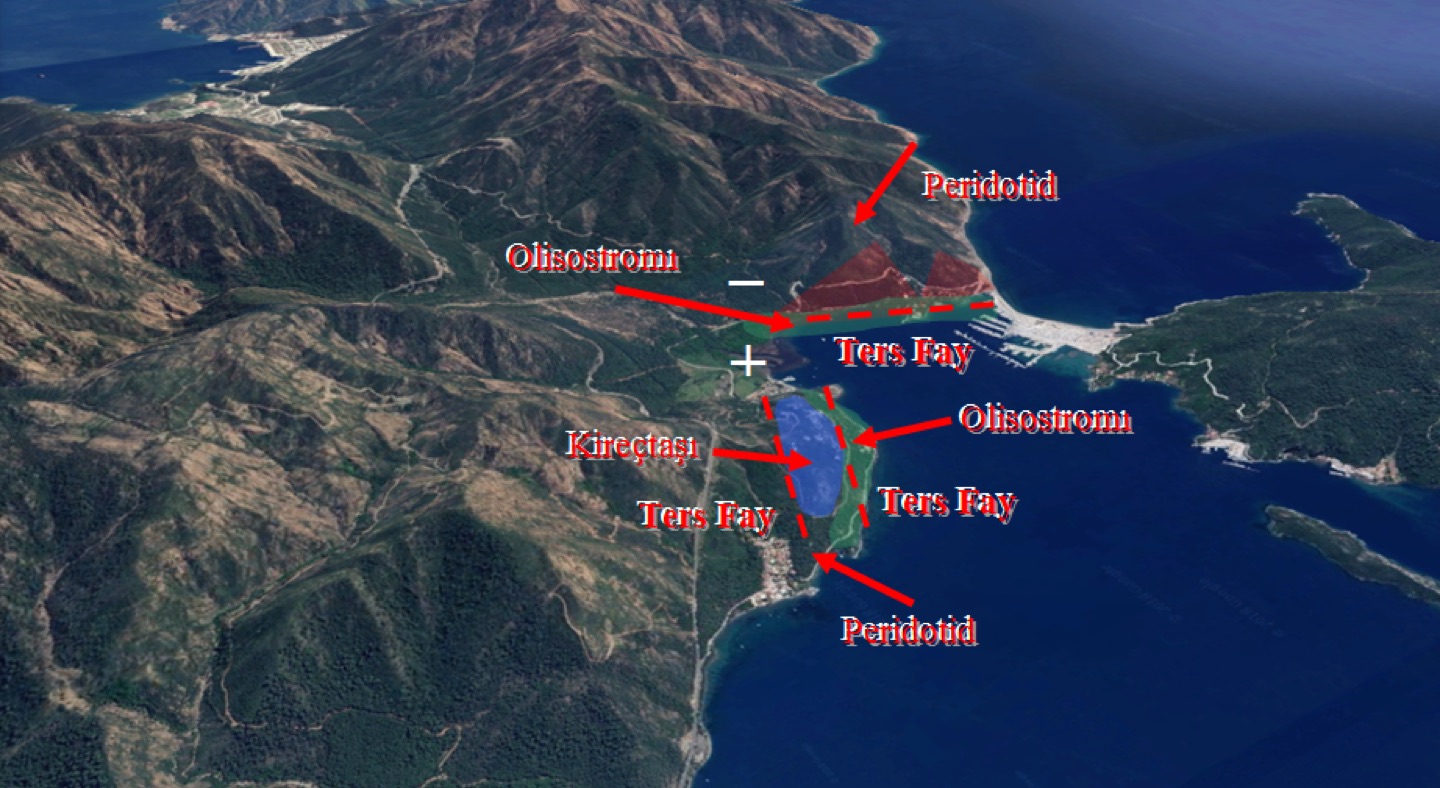
Did you know that this island was part of the mainland thousands of years ago? A fault split the mountain in two, and the detached section is still moving a few centimetres each year through the sea towards the opposite shore. In Marmaris, AquaHemithea is found only in active, moving fault zones of this kind.
Geology and field observations
Read the field notes
AquaHemithea’s thermal mineral water was identified through more than ten years of geological, geophysical and hydrochemical investigations in and around Marmaris, carried out jointly by academics from Istanbul University and our company’s specialist engineers.
Geology and field observations
Marine research
Read the field notes
AquaHemithea Marine Seismic Survey
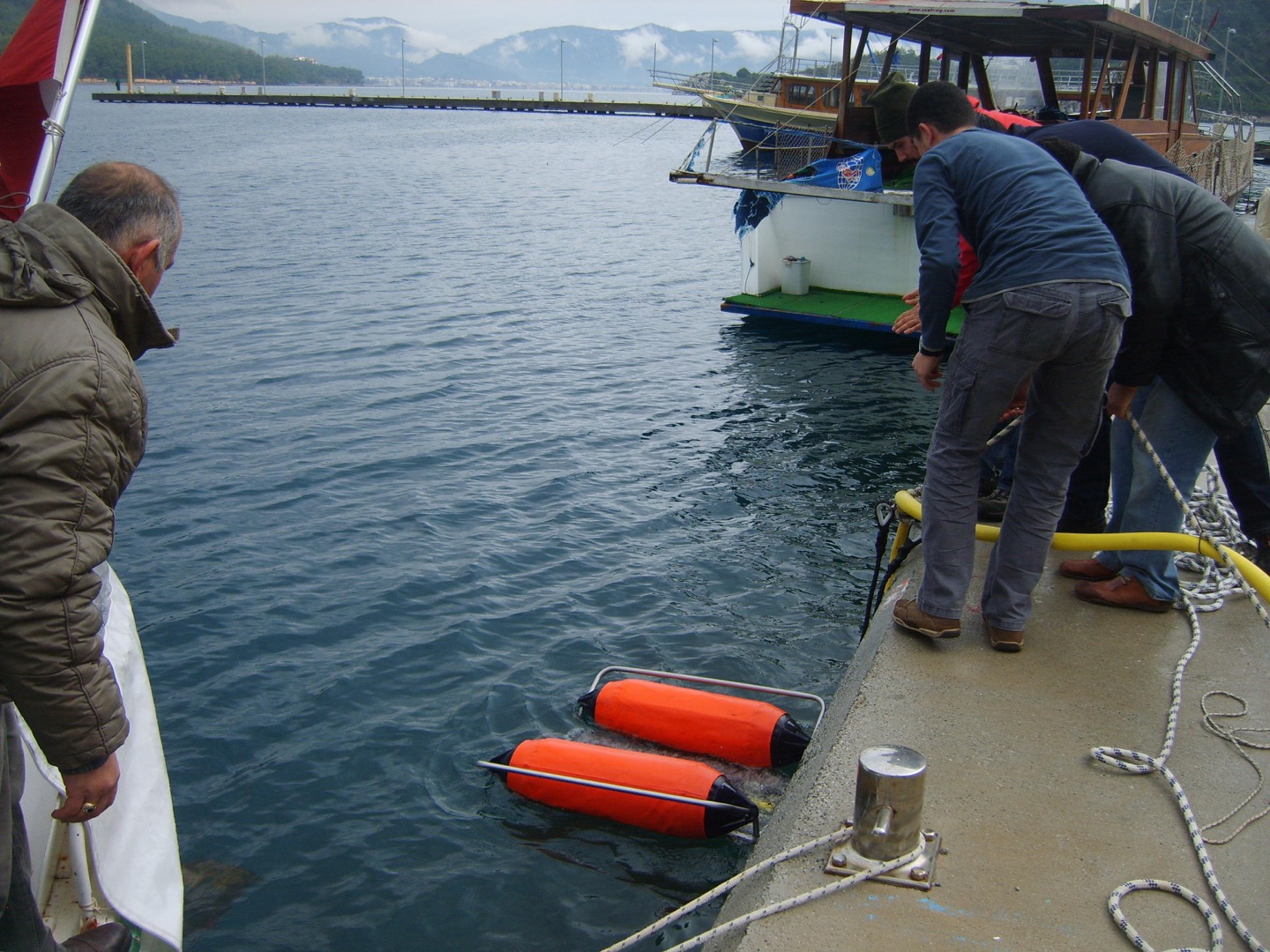
Alongside geological, geophysical and drilling work on land to assess Marmaris’s thermal spring water potential, we broke new ground with marine research, carefully evaluating the data gathered beneath the sea…
Marine research
Read the field notes
AquaHemithea Marine Seismic Survey
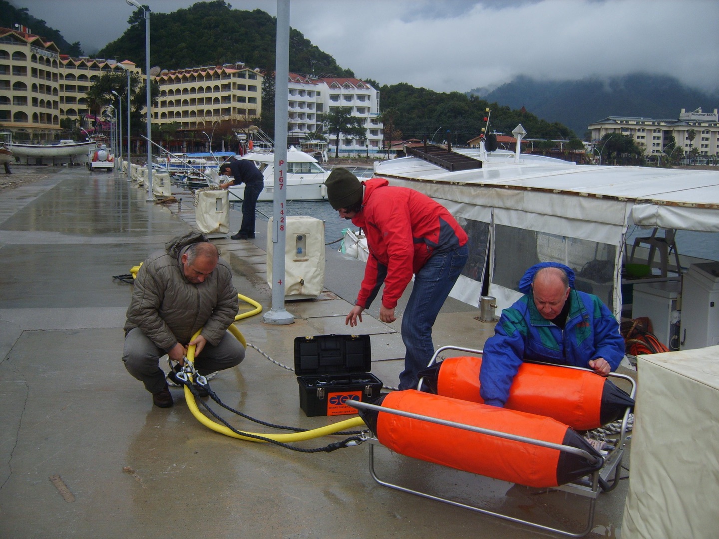
The seismic refraction equipment is ready to locate a fracture that formed beneath the sea at Marmaris 120 million years ago, and to investigate how the thermal-water-bearing geological formations connect to the land.
Marine research
Read the field notes
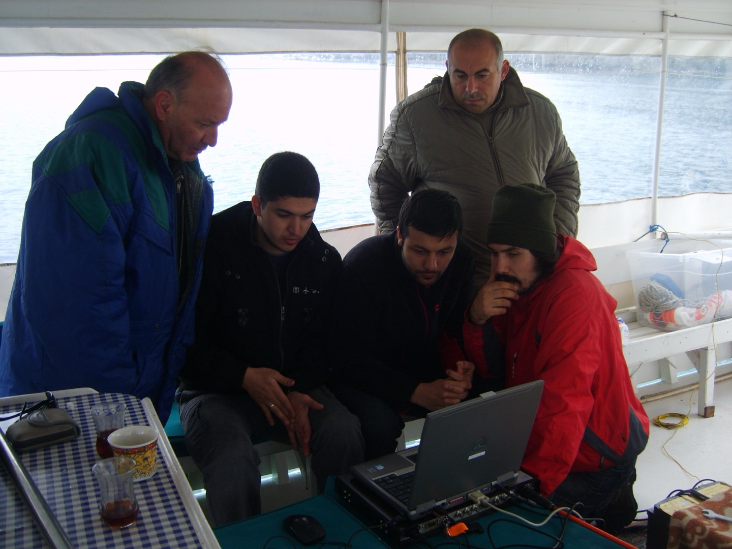
Where beneath the seabed is the active fault that shook Marmaris with a magnitude 5.2 earthquake in 1999 and continues to produce frequent magnitude 3 tremors? By identifying the fault’s position, route and connection to the land, we can determine which geological formations contain the AquaHemithea thermal spring.
Marine research
Read the field notes
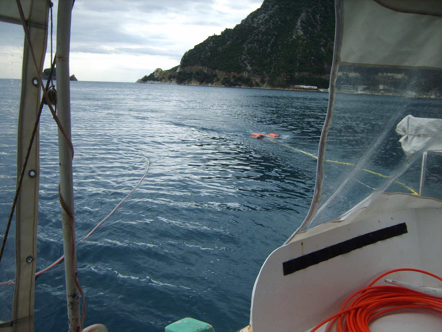
On which side of the active fault are the underwater volcanic rocks carrying the thermal water that could revitalise tourism in Marmaris? In which direction do they extend, which geological formations contain them, and how deep do they lie? We can answer these questions by using seismic tomography to scan beneath the seabed, centimetre by centimetre and to depths of hundreds of metres, much as a scan examines the human body.
Geology and field observations
Read the field notes
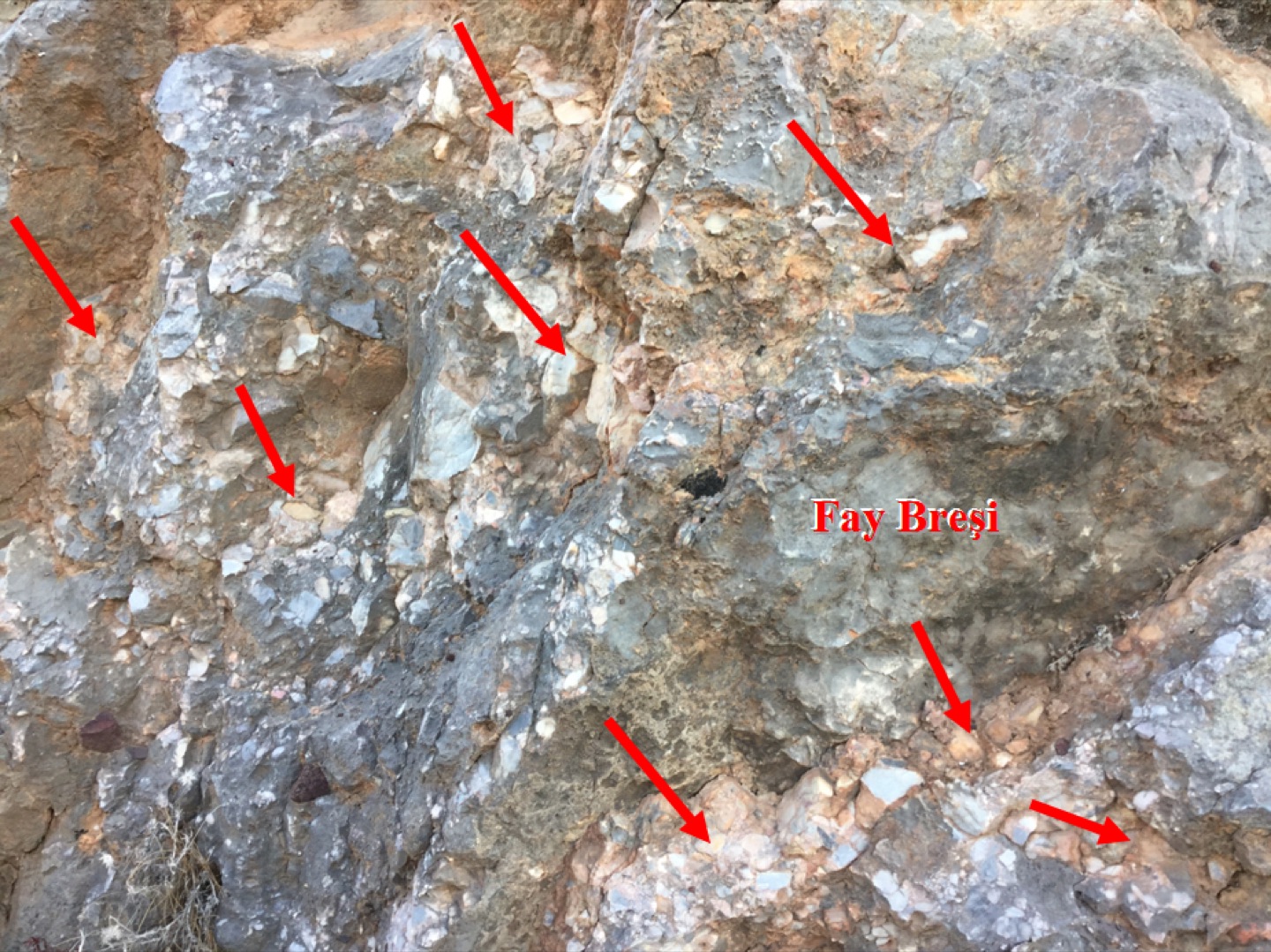
In our search for AquaHemithea, we examine breccias formed where active faults have sliced through and fragmented limestone. These breccias guide us towards the thermomineral waters found only in active fracture zones.
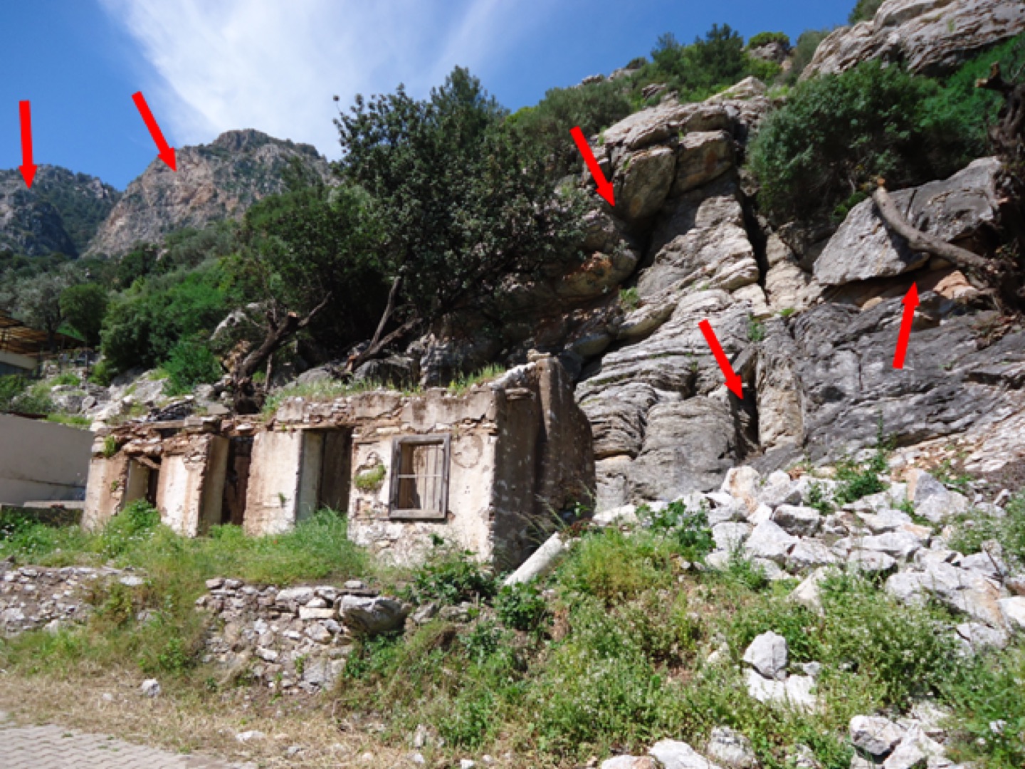
Geology and field observations
Read the field notes
In our search for AquaHemithea, we encounter the ORHANİYE FORMATION, a driller’s nightmare and one of the world’s most intensely fractured, fissured and cavernous formations. Drilling a geothermal well here is almost impossible: it loses water and continually collapses.
Magnetometric surveys
Read the field notes
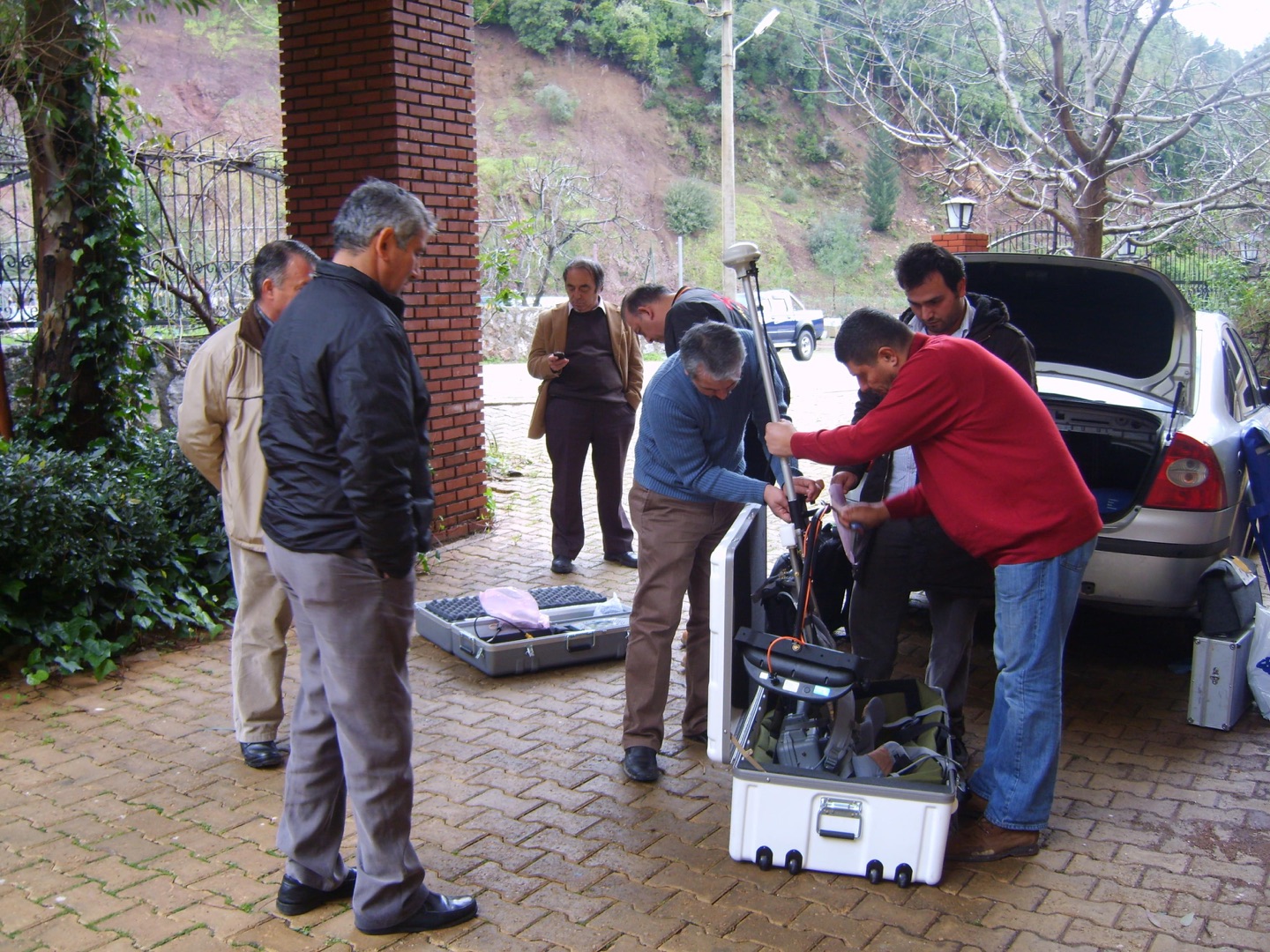
AquaHemithea Magnetometric Surveys
Magnetometric measurements form part of our land surveys to examine Marmaris’s tectonic structure and identify the geological strata containing AquaHemithea thermal water.
Magnetometric surveys
Read the field notes
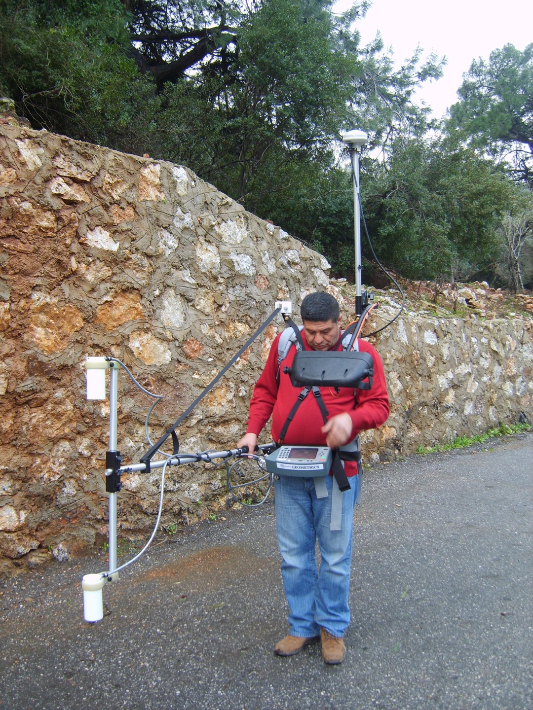
AquaHemithea Magnetometric Surveys
A caesium proton magnetometer, one of the world’s most sensitive instruments for subsurface geophysical measurements, will allow us to view in three dimensions the geological zones associated with fractures, fissures and caves in the mountains of Marmaris that contain AquaHemithea thermal water. The research team wants to see the fractures, fissures and caves formed by the fault that cuts right across Marmaris, because the AquaHemithea thermal spring may lie somewhere within them.
Geology and field observations
Read the field notes
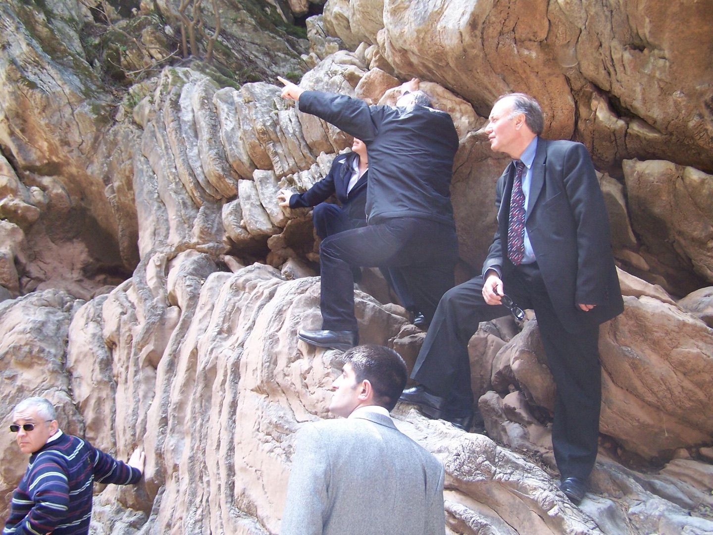
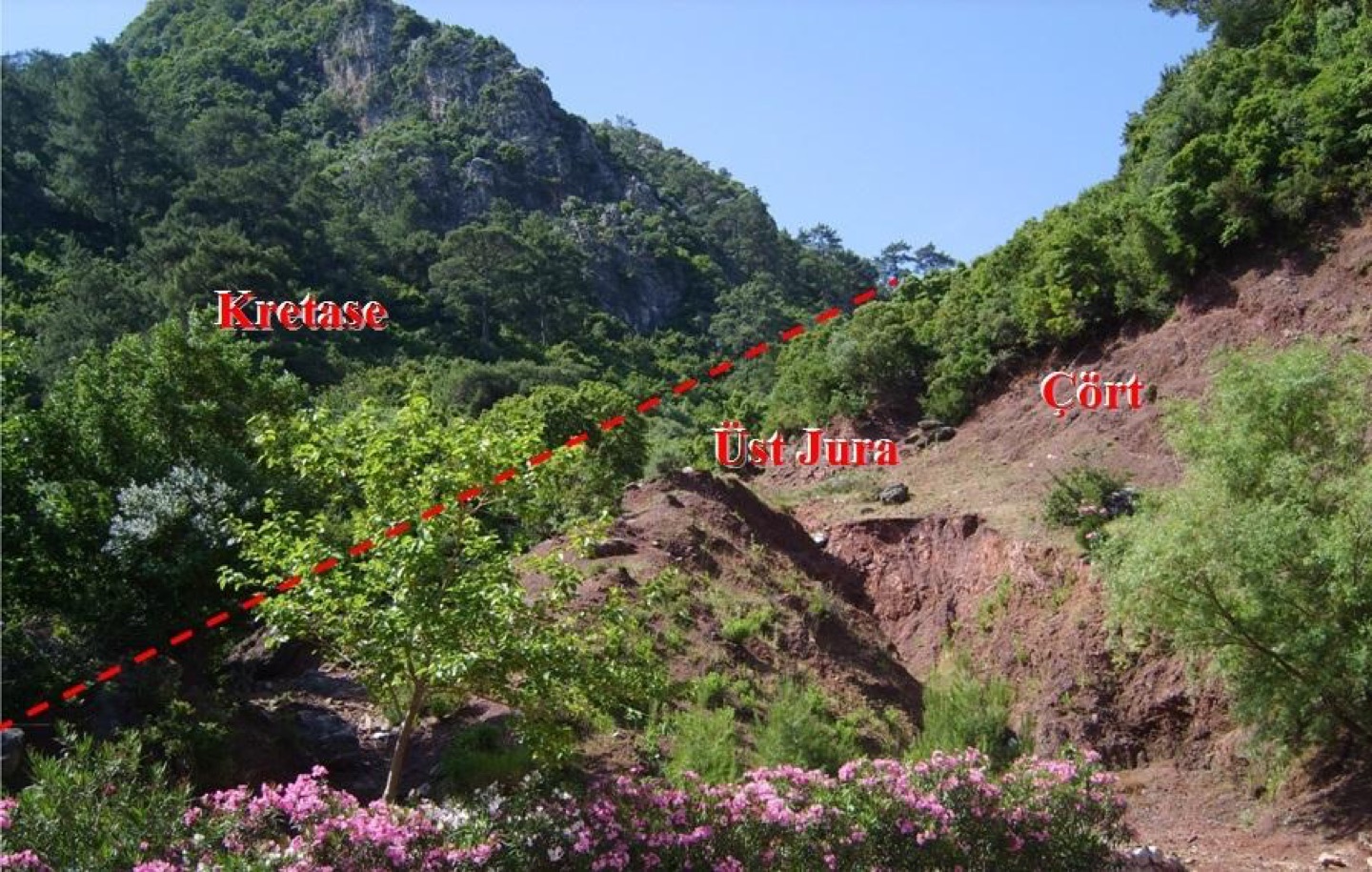
Cretaceous limestones crop out at the top, with Upper Jurassic cherts immediately below. These units should lie beneath the Marmaris Peridotite. What tectonic processes could have produced this geological structure?
Geology and field observations
Read the field notes
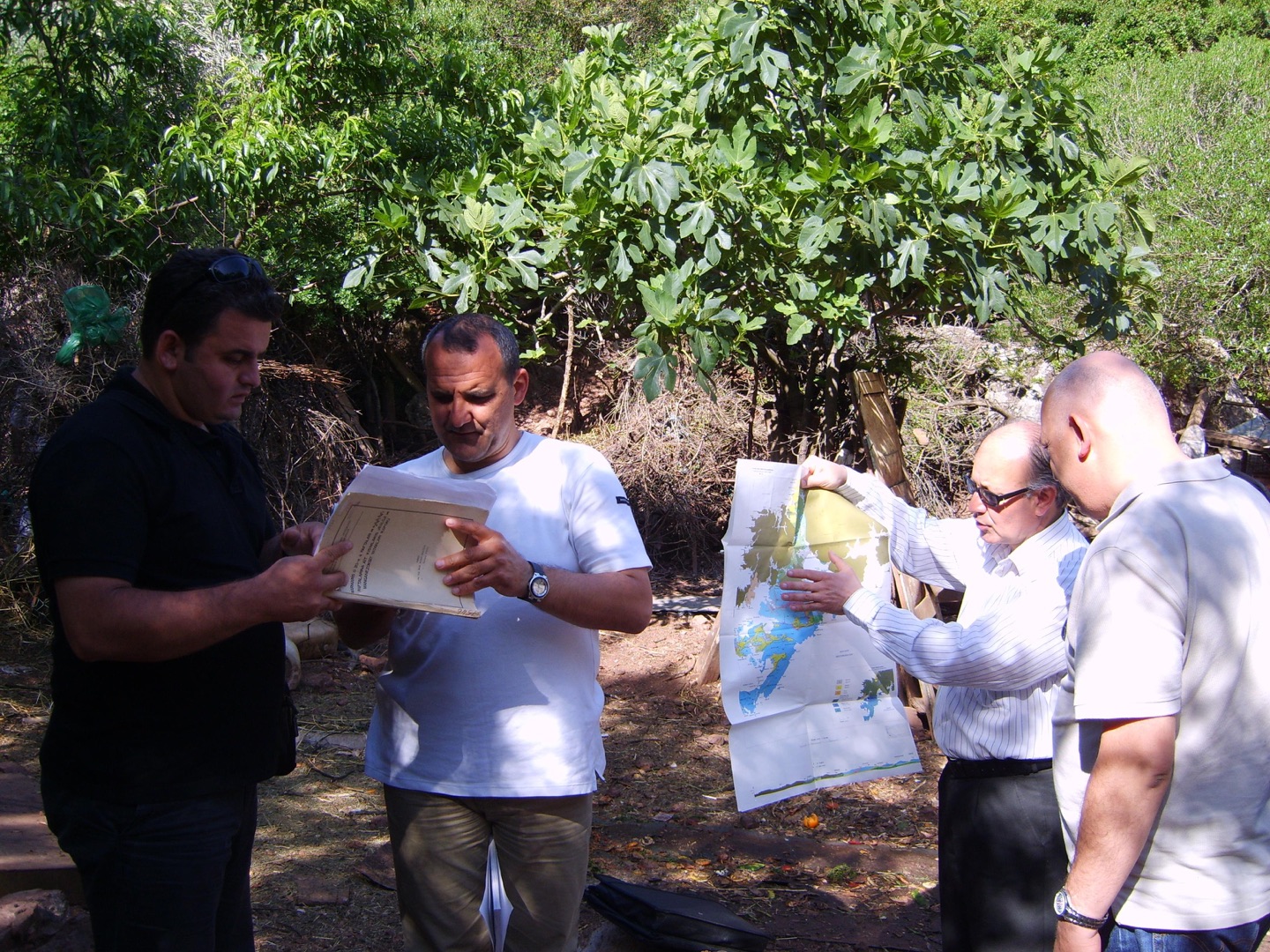
Understanding this could give us a clue to the stratigraphic sequence in which AQUAHEMITHEA, Marmaris’s thermomineral water, is found.
Geology and field observations
Read the field notes
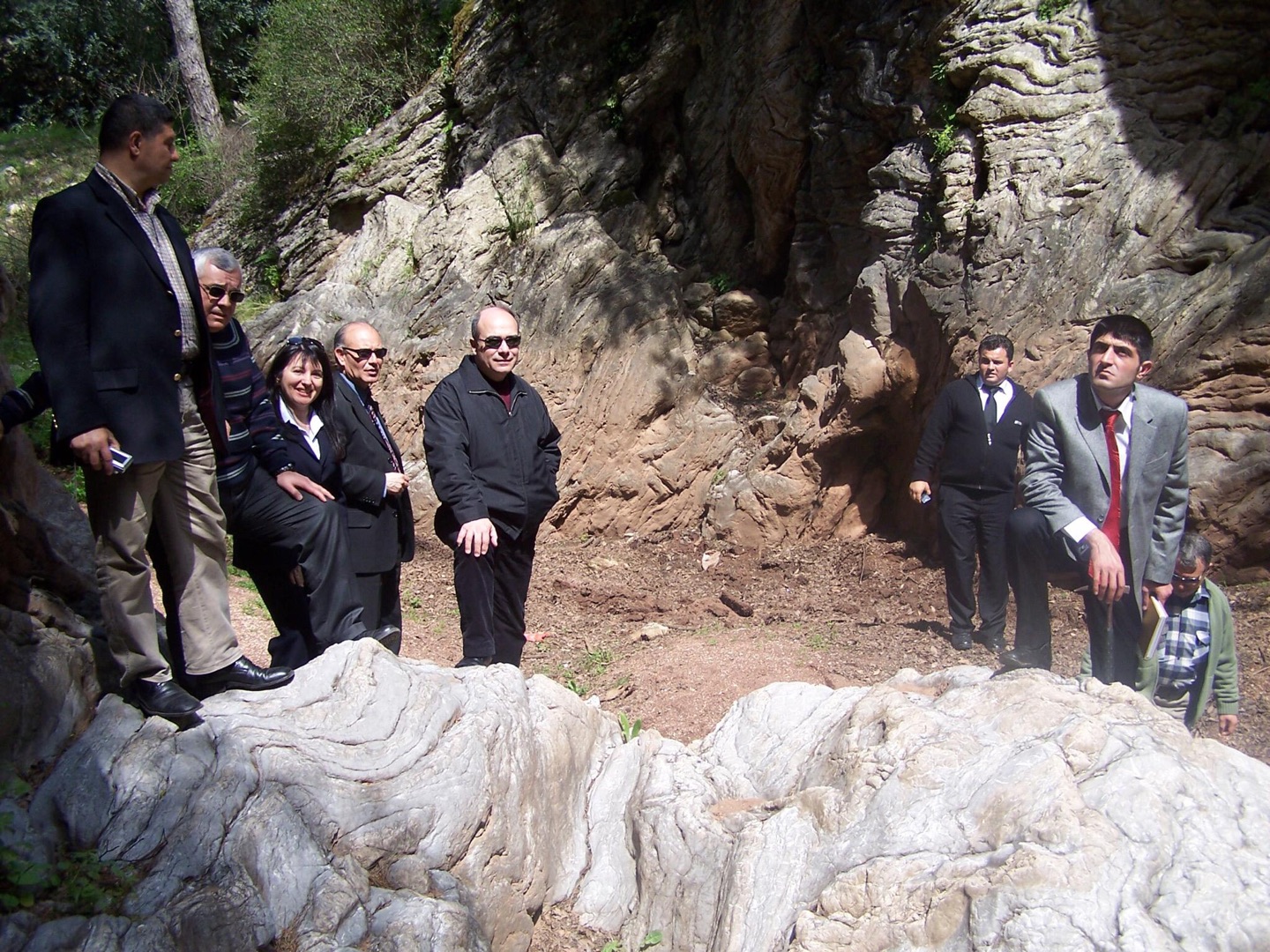
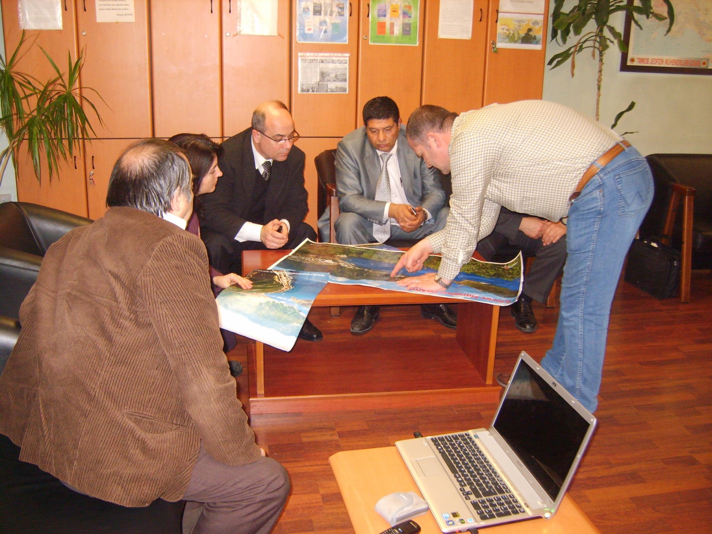
Academics from İstanbul University discuss the geological and tectonic structure of Marmaris. The work aims to introduce thermal tourism to Marmaris and bring visitors to the district from across Europe throughout the year.
Geology and field observations
Read the field notes
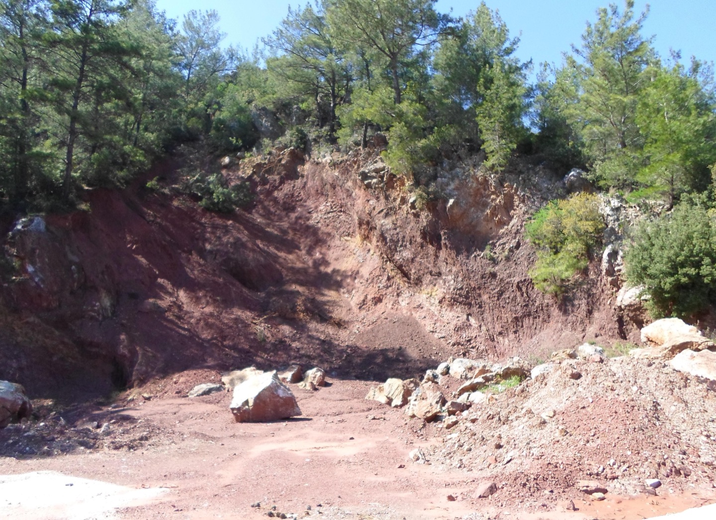
As we search for AquaHemithea, Marmaris’s ancient thermal spring, we encounter radiolarian-bearing geological units. Their high iron content turns red as it oxidises, staining the surrounding rock.
Geology and field observations
Read the field notes
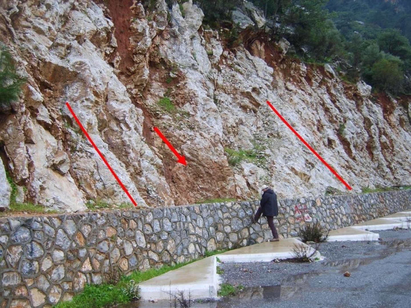
We are examining the internal tectonic structure of the mountains surrounding Marmaris. Which surface strata, dipping in which direction, allow rainfall to recharge the thermal-water-bearing rocks hundreds of metres below? Reverse faulting has made Marmaris’s horizontal structure and vertical stratigraphic sequence exceptionally complex. If the dip of the strata is overlooked and drilling takes place on the wrong side, the AquaHemithea water-bearing zone could be missed.
Geology and field observations
Read the field notes
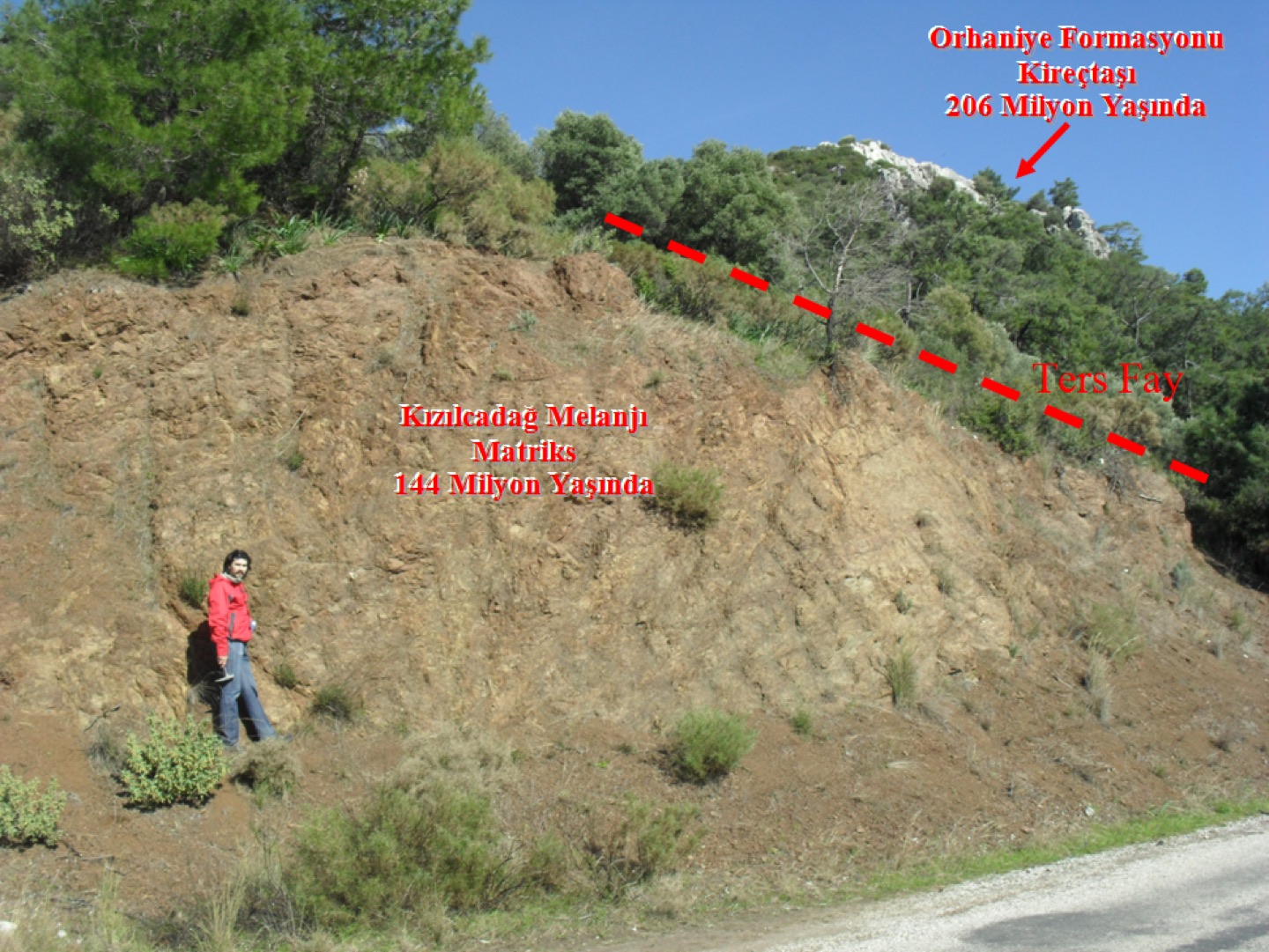
Three nappes and two reverse faults (thrusts), all in one place. As we search for AquaHemithea thermomineral water, Marmaris’s tectonic structure continues to astonish us. We see Dogger-age limestones of the GÖÇGEDİĞİ FORMATION, the lowest geological unit in Marmaris’s stratigraphic sequence, thrust over the Senonian-age Kızılcadağ Mélange. A further reverse fault has pushed this serpentinite-matrix mélange over the Jurassic limestones of the Orhaniye Formation. The Göçgediği Formation belongs to the Bodrum Nappe, the Kızılcadağ Mélange to the Marmaris Ophiolite Nappe, and the Orhaniye Formation to the Gülbahar Nappe. Another surprise is that the nearest outcrops of Göçgediği limestone are found only around Kumlubük–Amos, 10 km away as the crow flies. In which nappe, and in strata cut by which reverse fault, was the ancient spring AquaHemithea located? (The answer emerged from geological and geophysical research that began in 2009 and has continued since.)
Geology and field observations
Read the field notes
Do not be misled by the limestone blocks appearing on top: in the normal stratigraphic sequence, they should lie beneath the mélange. The limestones are Jurassic, while the mélange is Cretaceous, so the serpentinite matrix is younger than the carbonate masses. The matrix occurs within the sequence at a depth of at least 600 metres. Jurassic rocks formed 206 million years ago have exchanged positions with Cretaceous rocks dating back 144 million years. In other words, as we descend below the surface, the rocks become younger rather than older. This is Marmaris, home to some of the world’s most unusual tectonic structures. To find the ancient water of AquaHemithea, we need to unravel this remarkable arrangement.
Geology and field observations
Read the field notes
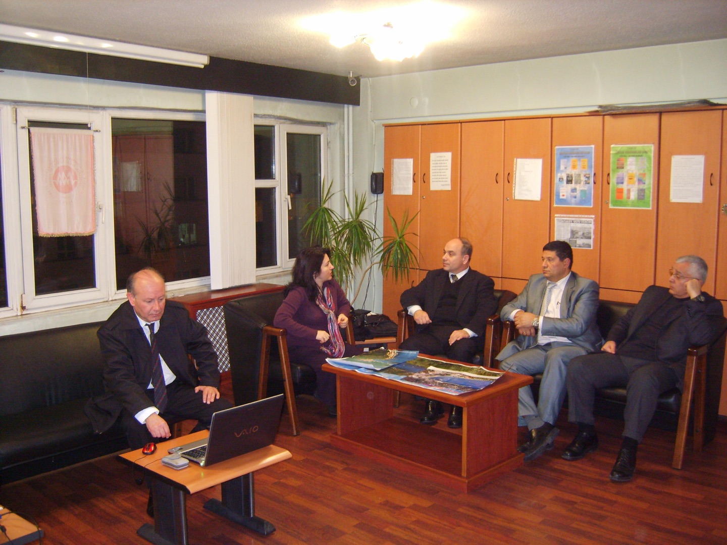
Scientists are working to understand Marmaris’s seismotectonic characteristics. Every piece of data from geological and geomorphological field observations and geophysical instruments is carefully assessed. The epicentres of earthquakes over the past 2,000 years, along suspected active fault routes in the region, are plotted on maps. Water temperatures at local fountains and changes in coastal sea temperatures are recorded individually, while the chemical composition of the waters is analysed and compared. All this work aims to identify the fracture systems containing the ancient water associated with healing and beauty in Marmaris’s Carian past, and to understand their tectonic structure.
Geology and field observations
Read the field notes
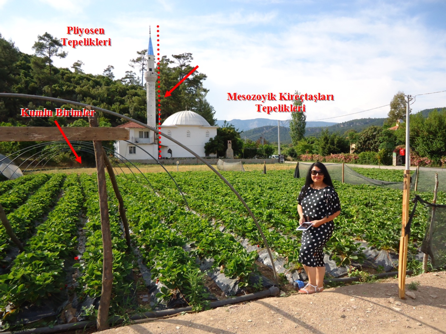
In our search for AquaHemithea, we come across the gently shaped terrain of the Pliocene, the youngest rock assemblage in our study area, and a strawberry field containing sandy, gravelly sediment formed by its erosion. Across the way, the steep, rugged slopes immediately reveal the presence of limestone. If we could return to pick strawberries here in a few thousand years, we would find the balcony of the mosque in the background higher than it is today. The geological structures here, including the Pliocene formations, rise further above sea level with each earthquake in the region. Our question is: why is the Pliocene here? Did the faults cutting the Cretaceous formations develop at that time? If so, the thermal water we are seeking, AquaHemithea, lies at a young tectonic contact.
Marine research
Read the field notes
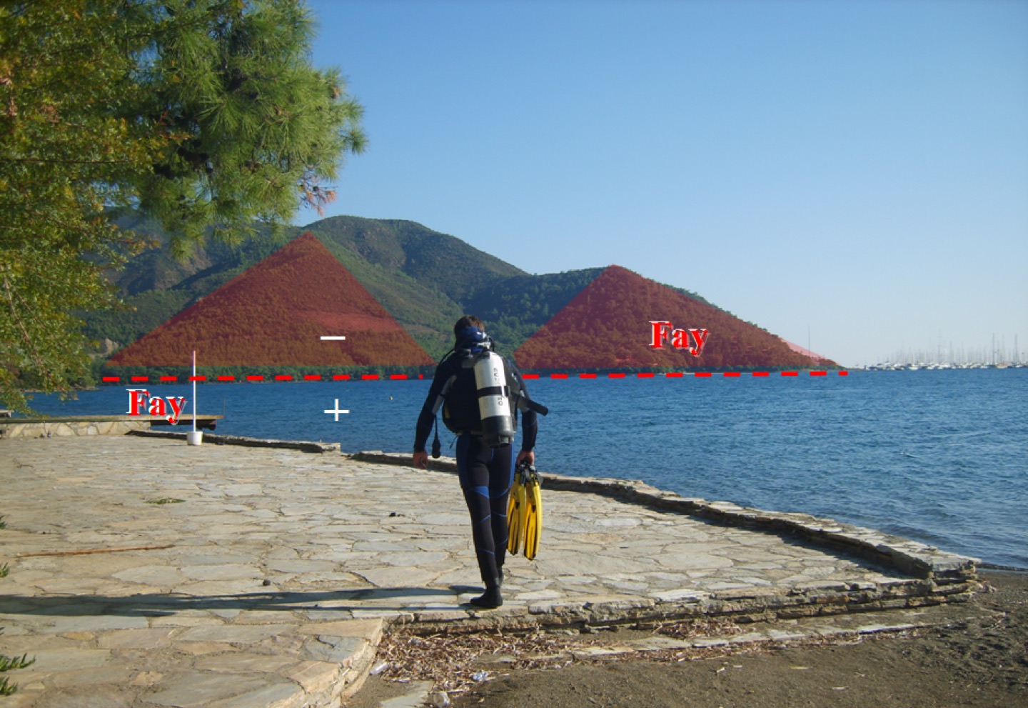
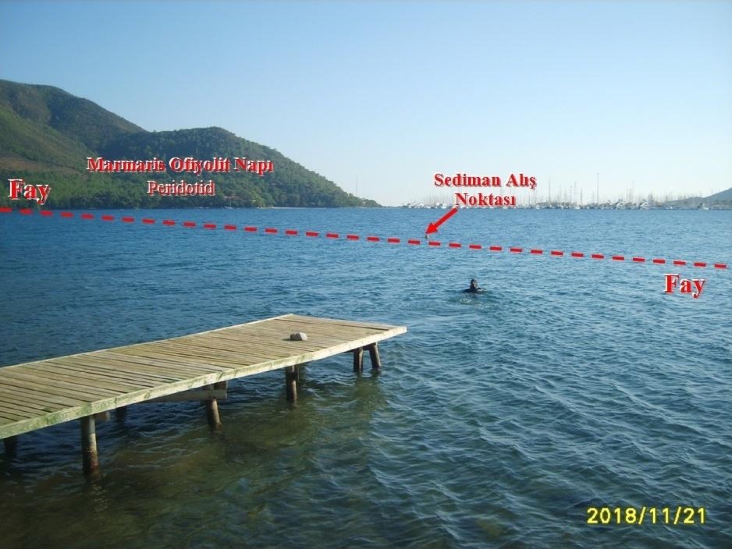
We continue to turn our research area inside out, exploring beneath both the land and the sea. The faults probably did much of that work before us, some 5.5 million years ago. A naval underwater defence commando diver is about to examine sediments around the sonar and seismic trace of the fault that divides the sea at Marmaris. Will we find particles from undersea volcanic activity that indicate thermal water rising from the depths towards the surface?
Marine research
Read the field notes
We are above the fault that divides Marmaris, whose route we identified through marine geophysical (seismic) and seabed sonar surveys. We are looking for fine seabed sediments. Finding particles associated with marine volcanic activity among these tiny fragments could be one indication that our research is on the right track.
Geology and field observations
Geology and field observations
Read the field notes
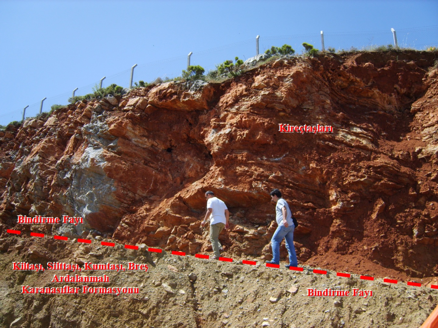
As we work to understand Marmaris’s geology, we examine every outcrop we encounter. Here, thrusting has placed limestone above an alternating sequence of siltstone, sandstone and breccia in an unconformable arrangement: the Güverdağı Formation above, and the Karanasıflar Formation below.